3.2 km | 6.2 km-effort
Hérémence tour
amnysia
User
Length
37 km
Max alt
1505 m
Uphill gradient
1809 m
Km-Effort
61 km
Min alt
514 m
Downhill gradient
1812 m
Boucle
Yes
Creation date :
2021-03-06 21:35:47.508
Updated on :
2021-03-08 16:48:45.915
4h09
Difficulty : Very difficult
FREE GPS app for hiking
About
Trail Mountain bike of 37 km to be discovered at Valais/Wallis, Hérens, Saint-Martin (VS). This trail is proposed by amnysia.
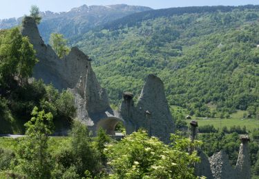
Positioning
Country:
Switzerland
Region :
Valais/Wallis
Department/Province :
Hérens
Municipality :
Saint-Martin (VS)
Location:
Unknown
Start:(Dec)
Start:(UTM)
379487 ; 5113118 (32T) N.
Comments
Trails nearby
Euseigne - Hérémence
On foot
Easy
Hérémence,
Valais/Wallis,
Hérens,
Switzerland
5.2 km | 9.7 km-effort
2h 12min
No
La Combe - Nax
On foot
Easy
Mont-Noble,
Valais/Wallis,
Hérens,
Switzerland
6.3 km | 9.8 km-effort
2h 13min
No
Le Louché Lac - Col du Cou
On foot
Easy
Mont-Noble,
Valais/Wallis,
Hérens,
Switzerland
3.7 km | 6.3 km-effort
1h 26min
No
Le Louché-L'Ar du Tsan Lac (A)
On foot
Easy
Mont-Noble,
Valais/Wallis,
Hérens,
Switzerland
3.6 km | 5 km-effort
1h 8min
No
Volvovron - L'A Vieille
On foot
Easy
Evolène,
Valais/Wallis,
Hérens,
Switzerland
4.2 km | 10.3 km-effort
2h 20min
No
vallée de la borgne
Nordic walking
Very easy
Hérémence,
Valais/Wallis,
Hérens,
Switzerland
10.8 km | 15.4 km-effort
5h 22min
No
Trajet du 28.10.21
Walking
Very difficult
Saint-Martin (VS),
Valais/Wallis,
Hérens,
Switzerland
14.8 km | 28 km-effort
6h 17min
Yes
Trajet du 27.10.21
Walking
Very difficult
Hérémence,
Valais/Wallis,
Hérens,
Switzerland
10.4 km | 22 km-effort
4h 57min
Yes